Averted Disaster Award 2023
Winner
Amrita Center for Wireless Networks & Applications
Revolutionizing Disaster Management: Empowering Communities and Saving Lives through Technological Interventions
In recent years, India has been grappling with an escalating frequency of natural disasters, and among these, landslides have emerged as a particularly impactful threat. The Himalayan and Western Ghats regions in the country are especially vulnerable to landslides, leading to numerous casualties each year. To address this pressing challenge, Amrita Vishwa Vidyapeetham, India, has pioneered a ground-breaking solution – AI-enabled Internet of Things (IoT) Landslide Early Warning System (Amrita-LEWS).
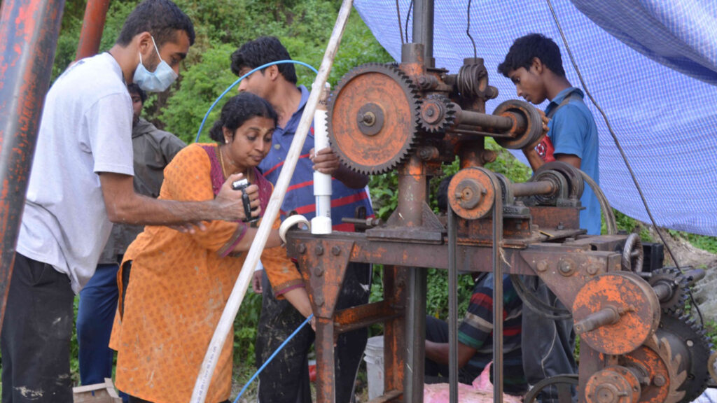
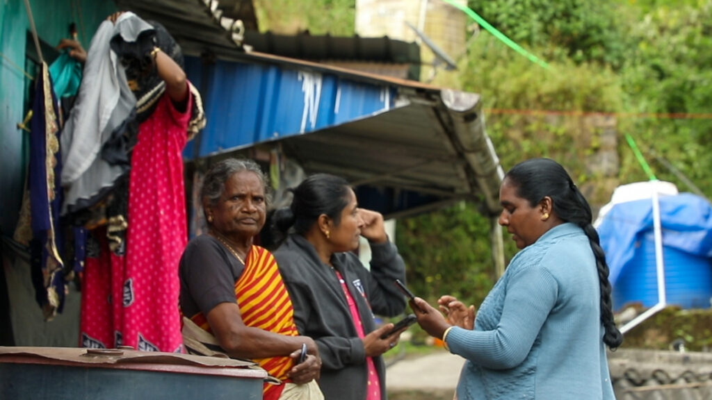
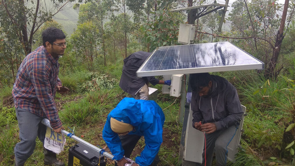
Landslides triggered by factors such as extreme rainfall, improper drainage, and human development activities have wreaked havoc on regions like Munnar in the southern state of Kerala. For years 2018 through 2022, the Munnar community has faced perilous situations during the monsoon season, jeopardizing their lives, livelihoods, and security. To combat this, Amrita Vishwa Vidyapeetham introduced the Amrita-LEWS, an innovative system consisting of more than 150 sensors strategically placed underground, ranging from the surface level to bedrock.
This system is a sophisticated amalgamation of AI, IoT, and data analytics. It continuously monitors an array of parameters – from rainfall, seismic actions, and moisture levels to pore pressure, vibrations, and inclinations. The collected data is then analyzed to predict the onset of landslides with impressive accuracy.
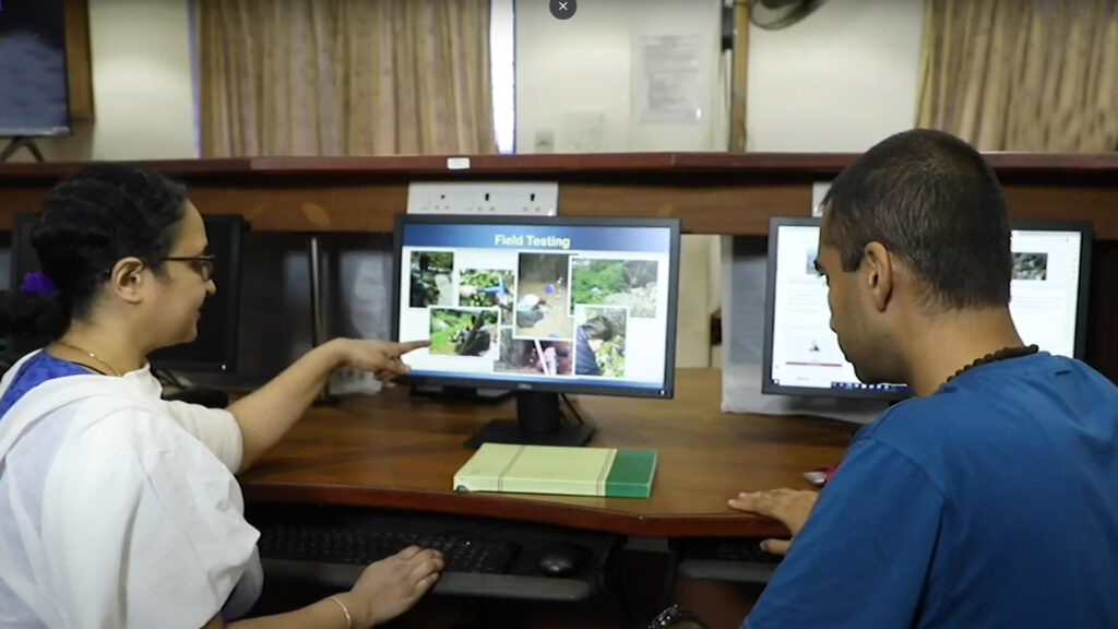
Notably, the system incorporates AI and machine learning techniques to forecast landslides with a lead time of 3 to 24 hours, thus providing a crucial window for evacuation and disaster preparedness.
What sets the Amrita-LEWS apart is its ability to monitor various types of parameters and offer multi-scale warnings for different types of landslides. By seamlessly integrating meteorological, geological, and hydrological data through an IoT framework, the system delivers timely and reliable early warnings. The technology has been rigorously tested, validated, and refined through real-world deployments, ensuring its effectiveness.
A more advanced iteration of this system has been operational in Chandmari, Sikkim, since 2018. Covering over 32 hectares, this extended version employs an array of geotechnical and geophysical sensors to monitor factors like moisture levels, pore water pressure, ground vibrations, tilting, and strain. Weather stations equipped with environmental sensors keep track of rainfall, temperature, humidity, solar radiation, wind speed, and atmospheric pressure. The real-time data from these sensors is transmitted to Amrita’s Control Center, where it undergoes detailed analysis to generate accurate predictions and facilitate informed decision-making.
This technological marvel hasn’t just remained confined to laboratories – it has proven its mettle in the field. Amrita’s IoT system has successfully issued early warnings for landslides on numerous occasions, including critical instances like July 2009, August 2011, August 2013, and more recently, in July and August of 2018, 2019, 2020, 2021, 2022 and 2023. These timely alerts have played a pivotal role in safeguarding the lives and properties of the Munnar community.
Two striking examples highlight the system’s effectiveness: In August 2020 and August 2022, regional landslide warnings were issued for the Western Ghats, specifically Munnar. In both instances, devastating landslides occurred within a mere 20 kilometers of the deployment sites shortly after the warnings. These incidents stand as testament to the reliability and accuracy of Amrita’s early warning system.
Yet, Amrita’s commitment to disaster management goes beyond technology. The institution is deeply engaged in fostering community resilience through comprehensive programs. Initiatives like the Landslide Tracker, a collaborative mobile app, and the Amrita Kripa app for real-time disaster management underscore their dedication to involving the community. Additionally, Social Media Mining Platform focuses on harnessing social media data for swift and inclusive multi-hazard event detection, aiding rescue and relief operations.
By intertwining technological prowess with community empowerment, Amrita Vishwa Vidyapeetham is revolutionizing disaster preparedness and mitigation. Through a decade-long journey of research, development, deployment, and operation, their AI- and IoT-driven systems have proven instrumental in not just saving lives, but also making communities self-reliant and resilient in the face of natural disasters. The experiences gleaned from real-world deployments in both the Western Ghats and the North-east Himalayas stand as a testament to the transformative power of technology when combined with a vision for societal betterment.
Averted Disaster Award 2023
Runner Up
Aga Khan Agency for Habitat, Pakistan
Fighting Avalanche Risk in the High Mountains of Pakistan
Background
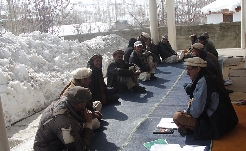
The northern regions of Pakistan, Gilgit-Baltistan and Chitral (GBC), home to some of the world’s largest mountain ranges including the Hindu Kush, the Himalayas and the Karakorum. These regions are characterised by rough and rugged terrain. Over 2 million people living in narrow gorges, foothills and steep terrains, face multiple natural hazards. Winters are long, harsh and isolating with heavy snowfall. According to news reports, only this year, some villages/valleys remained cut off from the rest of the country for more than 15 days (Nagri, 2023). The northern mountainous regions of Pakistan experience heavy snowfall and regularly witness snow avalanches during the winter and spring seasons (Gurung et al., 2023). As such these natural hazards pose a constant threat to human life, property, and critical infrastructure in these high-altitude mountain communities of GBC.
The Aga Khan Agency for Habitat, Pakistan, an agency of the Aga Khan Development Network, works with these communities to reduce disaster risk and adapt to climate change. Since 1992 AKAH has recorded more than 350 avalanche events in parts of GBC, resulting in the tragic loss of over 310 lives and causing numerous injuries. These avalanches have also left a trail of destruction, demolishing hundreds of houses, link roads, and critical infrastructure.
Averting Avalanche Risks
To identify, understand and address this natural hazard, AKAHP’s technical experts conducted extensive Hazard Vulnerability & Risk Assessments (HVRA) of villages and towns across GBC. The assessment data reveals that over 250 villages across only four out of 12 districts of GBC are exposed to immediate avalanche risks. Alarmingly, more than 1,100 households are at direct risk from these avalanches. While it may not be possible to stop avalanche events, AKAHP has pioneered a community-driven approach to help minimize these risks.
AKAHP Winter Preparedness and Avalanche Readiness Programme (WPRAP)
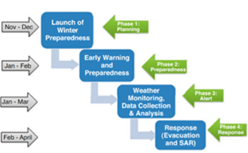
WPARP is a key aspect of AKAH’s Disaster Risk Reduction (DRR) and mitigation framework. AKAH Pakistan started its snow avalanche-related interventions in 2012, initially focusing on 10 villages that were extremely vulnerable to snow avalanches. With the increasing frequency of snow avalanche disasters in the region, this project has been expanded to over 250 villages across GBC.
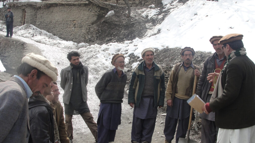
This seasonal preparedness programme is designed to monitor risks, generate early warnings and create awareness and develop community capacities (Nasab, 2021). As such, community-level response plans are developed to cater to avalanche incidents. Since the sustainability of this programme hinges on local actors, AKAHP has created and capacitated teams of trained village-level volunteers i.e., Community Emergency Response Team (CERT) to educate the local communities and to improve preparedness.
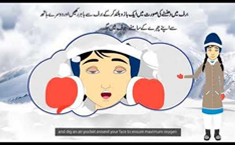
In addition to localized face-to-face training and awareness sessions, AKAH Pakistan has developed educational material like pamphlets, brochures, road signs and interactive videos (such as the one on the left) to educate communities about the key steps that one can take to protect themselves and their community from the threat of avalanches.
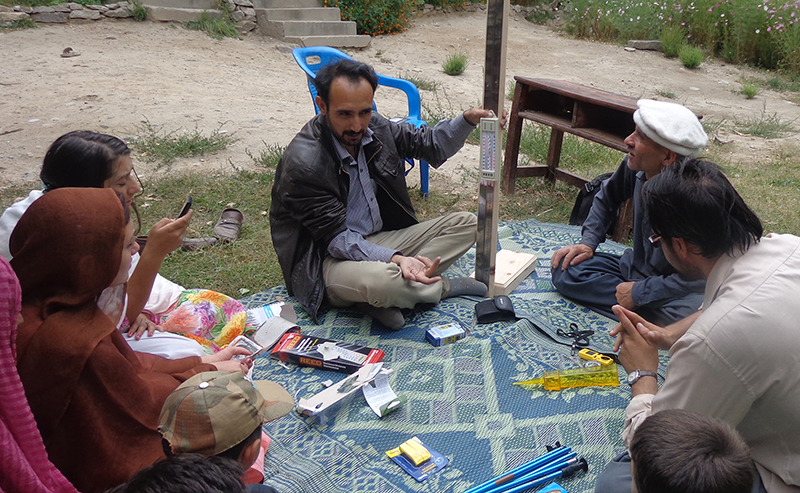
Localised Weather Forecasting
Remote mountain communities in Gilgit Baltistan and Chitral (GBC) lack accurate and timely weather forecasting and early warning systems. To fill this gap AKAH has established community-based Weather Monitoring Posts (WMPs), in 53 critical locations in remote valleys where avalanches pose a severe threat to human settlements. WMP volunteers trained by AKAH collect and report daily weather data on temperature, snowfall, wind, rain and more, as well as any data on avalanches that occurred.
AKAHP experts analyse this data and provide avalanche forecasts and alerts which are disseminated to communities by AKAHP’s through the local structures created as part of the disaster risk reduction framework.
AKAH’s winter preparedness programme promotes a community-based approach to disaster risk management. Training local volunteers to monitor daily weather and in em ergency response in at-risk villages has improved awareness, preparedness and trust of the community and reduced the challenges related to timely communication and evacuation. As the case of Ucho Gole in Chitral district shows, these efforts have helped save lives and build self-reliance.
The Story of UCHO GOLE
On 4th January 2016 in Ucho Gole, a village in Lower Chitral, the local weather monitoring and community emergency response volunteers received an avalanche alert from AKAH. One volunteer in the village rushed to disseminate the alert to 12 families who were living in the avalanche risk zone. Out of these 12, two (02) houses were in the extreme risk zone. When the volunteer reached one of the houses, the family was entertaining some guests who had come to visit them, having no idea about the looming danger. In the mountainous region, hospitality is elaborate and when the volunteer arrived, the family also offered him a hot cup of tea. Knowing the level of the imminent threat, sacrificing politeness, he refused the offer and convinced the family members and their guests to leave at once and evacuate to a safer location. Though they resisted initially, he was able to convince them to evacuate to safe place nearby just in time before an avalanche came down and destroyed their homes completely. Luckily, all of the family members, their guests and the volunteer (17 people) were saved and there was no regret in refusing tea.
Conclusion
AKAH’s winter preparedness programme has helped in saving lives through improving community preparedness It has also strengthened coordination among disaster management authorities including provincial disaster management, and voluntary bodies. Whenever an avalanche occurs, AKAH’s Search and Rescue Team (SART) volunteers, mobilise with local authorities and Rescue 1122 as first responders.
By community involvement and prioritizing the safety and well-being of those living in these vulnerable areas, we can make significant contributions towards reducing the risk and impact of avalanches in Pakistan’s mountainous regions.
Protecting mountainous communities from deadly avalanches requires a proactive approach that emphasizes timely, effective emergency response and long-term resilience-building initiatives, empowering communities with the knowledge and capacities to prepare, protect and recover from disaster.
Contributor:
Mehar Aftab, Communication Coordinator, Aga Khan Agency for Habitat Pakistan
Syed Gohar Ali Shah, Manager, Partnerships, Aga Khan Agency for Habitat Pakistan
Sher Wali, Manager, Risk Anticipation, Aga Khan Agency for Habitat Pakistan
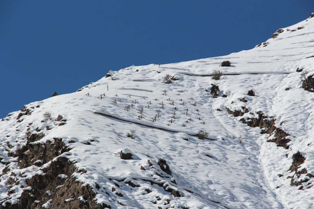
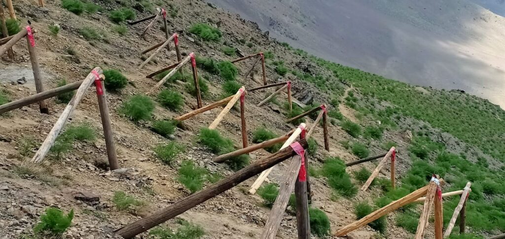
Avalache terracing at the trigger point at Khishwakht Washich, Upper Chitral
Wooden tripods installed at the avalachne triggering point in Kishwakhat, Washich, Upper Chitral
References
Gurung, D. R., Saratbekova, R., Sahim, S. A., Walizada, K. M., Wali, S., Karim, D., Dobariya, R., & Nasab, N. (2023). Community Resilience Through Local Action: AKAH’s Winter Preparedness and Avalanche Readiness Programme. In Springer eBooks (pp. 345–363). https://doi.org/10.1007/978-3-031-24541-1_16
Nagri, J. (2023, February 24). Snowfall, avalanches cut off GB, Chitral villages. DAWN.COM. https://www.dawn.com/news/1738837
Nasab, N. (2021, May 25). The Winter Preparedness and Avalanche Readiness Programme, a comprehensive avalanche preparedness plan in Afghanistan, Pakistan and Tajikistan. Adaptation at Altitude. Retrieved June 24, 2023, from https://adaptationataltitude.org/solutions-portal/the-winter-preparedness-and-avalanche-readiness-programme-a-comprehensive-avalanche-preparedness-plan-in-afghanistan-pakistan-and-tajikistan#:~:text=The%20Winter%20Preparedness%20and%20Avalanche%20Readiness%20Programme%20is%20a%20comprehensive,in%20Afghanistan%2C%20Pakistan%20and%20Tajikistan.
Averted Disaster Award 2023
Special Recognition
BBC MEDIA ACTION
Averting disaster with the power of media: BBC MEDIA ACTION
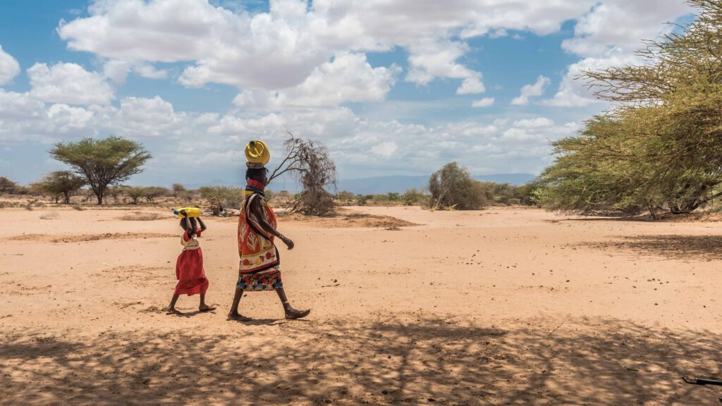
As drought threatens traditional pastoral communities in Kenya and Somalia, BBC Media Action is supporting media programming that can help families adapt.
Earlier this year, the World Meteorological Organisation forecast yet another below-normal rainfall for Kenya and Somalia – the sixth consecutive season of poor rains in the last three years.
The resulting drought has left an estimated 3.5 million people severely food insecure, and devastated the herds of traditional pastoral groups. An estimated 1.5 million animals have perished from depleted pastures and diminished water sources. In Marsabit, Samburu and Turkana counties in Kenya, over 90% of open water sources had gone dry, as of spring 2022.
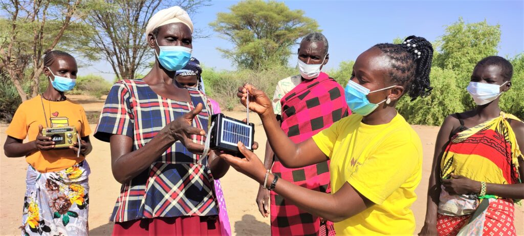
But information can help people make critical decisions and cope. And in these three worst-affected counties, families and communities have reported that they have been able to start kitchen gardens, harvest rainwater, improve how they manage their herds, and take other measures to help adapt their lives and livelihoods – because of stories shared and information they have learned through radio.
Joining up to provide essential weather and climate information
BBC Media Action has brought together media professionals and scientists to improve communication around essential weather and climate information, ensuring that it reflects people’s voices and needs. Our projects, Weather Wise – part of WISER, funded by the UK Met Office with back-funding from the UK Foreign, Commonwealth and Development Office; and Down2Earth, a consortium funded by the European Union – have built on tested methods of mentoring journalists and broadcasters using the editorial standards and principles of the BBC, while forging stronger connections with local climate scientists and Met officers.
Our first project, Weather Wise, addressed the existing disconnect between climate scientists, broadcasters, and their audiences. Climate scientists often produce technical research findings and projections, but farmers and pastoralists need information in simple, accessible local languages that they can apply to everyday challenges. A temperature provided in degrees Celsius means little to someone used to predicting weather using traditional methods and unaccustomed to reading a thermometer. And, despite efforts to improve weather and climate services in East Africa, our formative research found that their engagement with ordinary people is still relatively low due to the lack of reach, relevance, and accessibility.
Weather Wise approaches
Our Weather Wise project aimed to close this gap by improving access to, and knowledge of, climate and weather information amongst farmers, fishermen and pastoralists in Kenya, Uganda and Tanzania, through:
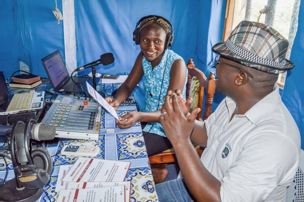
- Training and mentoring: Working with 10 local radio stations, we built the skills of media professionals from these three countries on effective communication of weather and climate information – ensuring they keep practical decision-making in mind. Working to editorial standards and values of the BBC we conducted in-house and remote training on topics such as appropriate formats, story packaging, and how to increase audience engagement.
- Relationship building: We supported local journalists to build networks with climate scientists, Met officers, agricultural extension workers and others essential to telling stories about climate change. Over time we persuaded these officials that investing their time speaking to and co-producing content with local journalists was an effective strategy to reach their target audiences.
- Encouraging partnership: We held workshops to bring together journalists and climate scientists – many of whom had not previously worked together – to forge new partnerships and networks, encouraging the co-production of high-quality climate media content.
- Audience feedback: We used our research with audiences to understand what radio content they found most useful and worked with the journalist to improve the content based on audience feedback. Our research showed station managers that their audience needed and appreciated this type of content and that they were using it to make decisions to improve their lives.
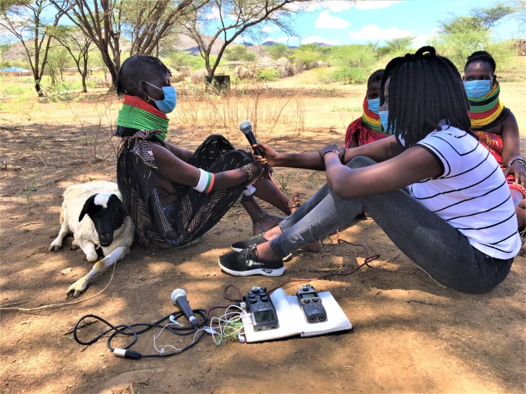
In our Down2Earth follow-up project, we worked with five broadcasters focused on Marsabit, Turkana and Samburu counties. For this project, we first built an understanding of media consumption, knowledge and attitudes in rural communities through research. We followed that with capacity-strengthening with local radio station partners through training, mentoring, equipment donation and building links with local climate scientists. Broadcasters then produced media content focusing on water scarcity, food insecurity and climate adaptation.
What our research found
Following both projects, our researchers found that listeners to these radio programmes understood climate change and its impacts, and were able to list actions they learned which could help them improve their livelihoods. For example, pastoralists spoke about evacuating livestock and families at times of heavy rainfall and flooding.
While some doubted the accuracy of weather forecasts, all listeners surveyed said they understood the importance of listening, and how the forecast can help them prepare. And even when limited finances prevented greater actions, listeners said they were able to apply their learning to some extent to help prevent losses.
As the drought continues, many in these communities are now benefitting from an improved ability to cope with extreme weather, from the information and inspiration they have received through radio.
Stories from our communities
“Being a pastoralist, there are a lot of challenges… such as lack of water and pasture ..People need to be trained and to gain skills so (they can) cope with the situation. I would encourage the youth to use social media and radio stations to gain information, especially on climate change …I have really learned some skills…I started a kitchen garden, and water harvesting.” — Wambaz, 25, an artist, radio presenter and farmer in Marsabit, Kenya
“The topics they discuss are relevant because they share information I need. I have learned a lot from the stories they share. I know that if I do certain things I will benefit, and I also know that if I continue to listen to it then it will benefit me, my household and my life in general.” —Female, Taru, audience member of Serian FM
“I heard them saying on radio that seasons have changed and that we should not just plant maize as we mostly do but plant other crops like sweet potatoes and kunde (cowpeas) that don’t require a lot of rain and that mature within a short time. I also heard them say that we should move our livestock to safer grounds to prevent them from being washed away by flash floods. Before I never used to have this knowledge and used to be caught unaware with rains when livestock were grazing away from home.”— Male listener of Jangwani FM, Logologo, Kenya
Essential components
This intervention, carried out over several years amid severe drought, can be easily replicated and scaled up to cover vast areas. We know from experience that people in even the most remote and rural locations can be reached where they are, through radio. Even in areas with little to no access to media, the provision of solar-powered or wind-up radios, loaded with content and shared with listening groups, ensures communities are reached with information that can be shared with others in participants’ families, communities and social networks.
Media and communication are essential in any climate action to reduce and mitigate risk. They work at speed, scale and low cost to reach audiences with timely, relevant and trusted information in languages they understand, to help them make critical decisions for themselves and their families. The information imparted in these projects will help families better cope with ongoing drought and extreme weather patterns – including through longer-term adjustments to their livelihoods for better economic security.
Averted Disaster Award 2023
Special Recognition
Prepared International (PPI)
The Professional Dialogue:
Strengthening Cross-Border Cooperation through Disaster Diplomacy
The current war activities between Israel and the Hamas underlines how crucial it is to find ways to save lives across conflict lines and support the civilian population. The “Professional Dialogue on emergency preparedness and lifesaving between Jordan, Israel and Palestine”, also known as the “Professional Dialogue”, is a unique disaster risk diplomacy scheme aimed at strengthening cross border disaster preparedness and response coordination in the Jordan, Israel, and Palestine (JIP) area with the end goal of saving and protecting lives. This intervention has significantly impacted the disaster-prone area and the conflict-affected communities in JIP, by utilizing the principles of disaster diplomacy to foster collaboration and address the unique challenges of the region.
Origins and Goal
The project was founded in 2013 by the Director of Prepared International (PPI) – a expert group founded by members of the humanitarian emergency management field to support communities – Dr. Albrecht Beck, while working for the United Nations Office for the Coordination of Humanitarian Affairs (UN OCHA). Dr. Beck started the negotiations in 2011, a time in which communication between the three emergency management systems was almost non-existent. These efforts translated into a series of bilateral training courses, kindly facilitated by Dr. Beck on behalf of UN OCHA, which initiated the disaster diplomacy project to better prepare the region and international assistance for a natural hazard event in the region, specifically, a large-scale earthquake event. As statistics demonstrate, there is a strong probability of an earthquake (M 6+) to occur along the Dead Sea Fault (DSF) Zone over the current decade, and the 2023 earthquake on the Türkiye – Syrian border is thought to have accelerated the likability of such an event to happen. Ultimately, the project aims to protect vulnerable communities in the JIP region, facilitate local cooperation, and enable international teams to assist affected populations and enable response in no-man’s land. Day to day cooperation in simple accidents, as well as coordination in mass-disaster events and during conflict, are all part of the dialogue’s focus.
Focus and Achievements
The project focuses on further strengthening collaboration among the three entities in disaster preparedness, supporting regional capacity building for earthquakes and floods, and supporting the response preparedness level of the humanitarian actors on the ground. Efforts towards this end culminated in March 2023, with the conduct of a large-scale field exercise in JIP, marking a milestone during the tenth anniversary of the dialogue. It was during this time that the three local entities cooperated with one another and the international community with utmost respect, and with the common understanding that without regional collaboration no one could unilaterally respond effectively and deliver timely humanitarian assistance to affected populations. Common SOP for enabling assistance across borders in the region were agreed on. Authorities came together several times for Table-Top simulations. Most importantly, such milestone was followed up by a second agreement on further solidifying the diplomatic efforts worth a decade of time. Because of this, Prepared International thanks each stakeholder for their outstanding commitment and perseverance through all this time, and will continue to support the three parties.
Key Events and Lessons
The exercise in March 2023 provided an opportunity to gain important lessons to implement in the next phases of the project implementation.
- The cycle of conflict and disaster is often revered when it comes to the growing number of failed and failing states. Without strategically designed disaster diplomacy, it will not be possible to break this cycle.
- It is critical to prepare disaster risk experts for the diplomatic work around such projects. For diplomacy projects heavily focused on disaster risk, diplomats are not the most suitable candidates.
- Trust is everything. From the beginning, it is key to establish trust between all stakeholders and to prepare them to leave their comfort zones. It is helpful to have one focal point in the project, with one line of contact who can organize, manage the project and see the big picture, just like PPI has done for the Professional Dialogue
· Finally, the best way to approach such a project is through a two-ways approach: top-down and bottom-up. Bringing together high-level personnel, who accept and learn to trust the project, and operational personnel, who work on the field level and cooperate with other stakeholders, is beneficial in reaching all levels of governance.
Promoting Cooperation and Understanding
This disaster risk diplomacy intervention allowed for developing a sense of mutual understanding and cooperation, thus enabling international teams to reach the Palestinian population during the response phase of a disaster. This milestone has provided a foundation for numerous preparedness projects in the region, since at the very beginning, most of the organizations were still “enemies”. In fact, contact was largely forbidden, which severely hindered any possibility of communication and cooperation during a disaster. Nowadays, after ten years and despite political tensions in the region, direct cooperation across conflict lines in the emergency and preparedness community takes place daily.
Disaster Diplomacy and Civil Protection Cooperation
The role disaster diplomacy played in all this in undoubted. Disaster diplomacy, at its core, is the utilization of disasters as a catalyst for diplomatic engagement, conflict resolution, and cooperation. It recognizes that during times of crises, political barriers can be transcended, and common interests in saving lives can create opportunities for dialogue and collaboration. Civil protection cooperation is the result in this case, of diplomatic efforts. It refers to the collaborative efforts and measures taken by different governmental entities to prevent, prepare for, respond to, and recover from disasters, coordinating with emergency management organizations, first responders, and humanitarian organizations.
Having worked in the field of disaster diplomacy and civil protection cooperation for years, PPI became a leading promoter in the fields. With a deep understanding of the complexities surrounding disaster management, PPI offers expertise in various areas, including civil protection, disaster diplomacy, climate change activities, violence and conflict resolution, food security and health. The organization’s comprehensive approach encompasses strategic planning, risk assessment, capacity development, policy development, investment plans, and more. PPI recognizes the significance of disaster risk diplomacy as a crucial aspect of its work, understanding that effective disaster management goes beyond technical solutions. By integrating disaster risk diplomacy into their projects, PPI aims to foster collaboration, dialogue, and cooperation among diverse stakeholders, including governments, international organizations, and local communities. Especially now, in times of climate-change, professional, well-planned disaster diplomacy and work in fragile and conflict-striven areas is getting more important than ever. The current situation in the Middle East even more shows the need for professional approaches, but also for donor support for it.
Albrecht Beck, Managing Director of Prepared International, Disaster Risk Diplomacy Expert
Antonia Vignolo, Project Officer in Disaster Risk Reduction and Climate Change Adaptation
Averted Disaster Award 2022
Honorable Mention
GeoHazards International, Landslide and Earthquake Risk Reduction, Aizawl India
We are proud to honor GeoHazards International and their efforts in landslide and earthquake risk reduction in Aizawl, India as a 2022 Averted Disaster Award Honorable Mention.
Since 2011 GeoHazards International (GHI) has served as a technical partner and advisor to the city of Aizawl, India in order to assist as they make progress in disaster resilience. Aizawl is a city in northeast India, located in its highest seismic hazard zone V where earthquakes of intensities above IX are expected. In addition to the high risk of earthquakes, annual monsoon rains in the area also trigger frequent and sometimes deadly landslides. With a population of 300,000 (per 2011 census), that is expected to double by 2030, the GHI team recognized the significant risk to life and livelihoods and the importance of implementing development practices to increase the city’s resilience in the face of a disaster.
In order influence the community to proactively implement interventions, GHI developed a scenario to demonstrate the consequences of a moderate, not worst-case, but hypothetical magnitude 7 earthquake and shaking triggered landslides. They presented their findings to policymakers and the public to help them visualize the specific impacts of the risk they face. This painted a stark picture of the collapse of 14,000 buildings (nearly 30% of all buildings), over 1,000 landslides and 25,000 fatalities (over 8% of the population at the time) as well as major damage to utilities and infrastructure. The estimates were even worse during monsoon season when wet conditions make slopes more prone to sliding.
GHI team members assisted the city as it launched the Landslide Policy Committee for Aizawl Municipal Corporation (AMC) with municipal, state, and technical participants. The Committee created a landslide safety Action Plan to prevent or remediate landslides based on the findings from the scenario, many of which have been or are in the process of being implemented. Examples of actions taken include:
· New site development regulations, which include controls on excavations that can destabilize slopes.
- High risk areas identified, mapped and used to create landslide hazard maps. These maps make it possible to enforce the site development regulations.
- Local professionals were trained on the new regulations.
- Hiring of geologists to implement the site development regulations.
- AMC empaneled 95 geologists, 142 engineers, 7 geotechnical engineers, and 9 firms to cater to the increased demands for regulatory approvals following the slope modification regulations.
Aizawl has become a model city for other fast-growing hill cities in the region. It’s the only city in India with municipal geologists that guide the city towards safer development. It’s also the only Indian city with slope modification regulations and detailed landslide hazard maps to enforce the regulations. India’s National Disaster Management Agency recognized Aizawl as an example for hill cities across the country.
GeoHazards International attributes persistence, sustained efforts and genuine local engagement as the keys to making a lasting difference.
Congratulations to GeoHazards International!
For more information about GeoHazards International visit GeoHazards International | Menlo Park | Disaster Preparedness
Averted Disaster Award 2022
Honorable Mention
Project NOAH, Philippines
We are proud to honor the works of Project NOAH as an Honorable Mention for the 2022 Averted Disaster Award.
The Philippine government created Project NOAH as the Department of Science and Technology’s (DOST) integrated disaster prevention and mitigation program in 2012. It was designed to employ science and technology to generate accurate data and address the conditions needed to make informed decisions for disaster risk reduction activities, through national government agencies, partners in the private sector and the academic community. Project NOAH seeks to fulfill its vision of disaster-free and empowered communities by providing open access to accurate, reliable, and timely hazard and risk information that has been updated and enhanced using advanced technology. It also undertakes research projects to develop technologies and tools that further build the capacity of the government and the public in disaster preparedness and response.
The Philippines is constantly under threat from natural hazards from typhoons, tsunamis, earthquakes, volcanic eruptions, and landslides. This is further compounded by the extreme weather conditions created by climate change, as well as ongoing infrastructure development and population growth. As a result, disasters continually inflict greater costs on the country, both in terms of damage to property and loss of life. This situation will persist, and even worsen, unless specific measures are immediately undertaken to specifically address the ability to provide enough lead time for vulnerable communities to prepare and withstand disasters.
To address these issues Project NOAH mapped the country’s flood, landslide and storm surge hazards and significantly improved the resolution of hydrometeorological hazard maps. The NOAH program also introduced the use of Web Geographic Information Systems in communicating hazards and developed a People-Centered Early Warning System in their disaster risk reduction efforts. Additionally Project NOAH has deployed more than 1,000 automated weather stations, rain gauges and flood sensors that stream near real-time data over the NOAH website. They have also institutionalized a strategic communications project that allowed the agency to provide hazard specific, area=focused and time-bound warnings to the public.
The compounded impact of investment in these disaster mitigation areas has resulted in significant lives, property and livelihoods saved. Through Project NOAH the Philippines government is creating a culture of safety and resilience in communities and changing the way we perceive and experience disaster events.
Congratulations Project NOAH!
For more information about Project NOAH visit Project NOAH (Nationwide Operational Assessment of Hazards) – NOAH Center (up.edu.ph)
Averted Disaster Award 2022
Runner Up/Intervention of Distinction
Build Change
Resilient Housing, Philippines
We are proud to honor Build Change and their efforts in resilient housing in the Philippines as a 2022 Runner Up/Intervention of Distinction.
Since 2014 Build Change has implemented resilient housing solutions in the Philippines and provided engineering, technology, and lending solutions to design, build and finance over 3,000 safer buildings. This represents 40,000 people living and learning in safer houses and schools. They facilitated behavioral change in homeowners and builders by training over 5,000 people in safe construction practices creating 600 jobs.
The Philippines ranks as the eighth most disaster-prone country in the world based on the World Risk Index. The country is particularly exposed to typhoons, flooding, earthquakes, and landslides. In 2019 Build Change estimated there were over 15 million vulnerable housing units in the Philippines urgently needing improvements with the vast majority belonging to poor and low-income families. In 2020 alone, over 5 million Filipinos and more than 425,000 homes were negatively impacted by typhoon and earthquake events.
The experience of Eusi and Helen Raloso is one example of disaster averted through resilient housing efforts. On November 8, 2013 the Raloso’s first home was destroyed by Typhoon Yolanda. They hid under a table for protection while their house collapsed around them. Their son was injured. They thought they would die.
The family received emergency food, water, and clothing. Then, with engineering, construction, and financial assistance from Build Change and its partners, Eusi and Helen built back better. They constructed a stronger, disaster-resilient home. Helen managed the money and Eusi managed the builders.
The strength and safety of the Raloso’s new home has been tested since it was built in 2014, withstanding the increasing frequency and intensity of climate change induced weather for nearly eight years. After Typhoon Yolanda (Haiyan), some of the most devastating typhoons have followed a similar path through their community. Further, the Raloso’s home has served as an evacuation center for family members and neighbors.
Build Change recognizes that a home is the ultimate protection for families. Resilient housing not only mitigates risk of damage or collapse, but enhances the wealth, health and well-being of occupants. Resilient housing helps save lives, protect assets, create jobs and spur local economies. They prevent the loss of livelihoods, prevent relocation and irregular migration after a disaster and help provide a cost effective and long-term solution to the qualitative housing deficit.
Elizabeth Hausler, the founder and CEO of Build Change says “It is completely possible to build and strengthen houses to better withstand earthquakes, windstorms and other hazards and prevent such a disaster. It’s not the earthquake or typhoon that kills people, it’s the collapse of a poorly built structure…it just takes the right combination of people, political will, financing and technology to solve it’.
Congratulations to Build Change!
For more information about Build Change visit Build Change | Build Disaster Resistant Buildings and Change Construction Practices Permanently
Averted Disaster Award 2022 – Winner
Bangladesh Red Crescent Society
Forecast-based Financing, Bangladesh
We are proud to honor the Bangladesh Red Crescent Society as the winner of the 2022 Averted Disaster Award for their efforts in Forecast-based financing in Bangladesh!
The Bangladesh Red Crescent Society won the Averted Disaster Award for their work providing forecast-based financing to vulnerable communities during successive extreme events in Bangladesh May-July 2020. On May 20, 2020 Super Cyclone Amphan made landfall in Bangladesh. A few weeks later monsoon flooding affected Bangladesh for several weeks reaching their highest levels since 1988. 37% of Bangladesh’s landmass was flooded and affected 5.4 million people in the north, northeast and center of the country.
Forecast-based financing, an anticipatory approach implemented by the Red Crescent Society proved highly effective at averting the impacts of floods and cyclones in Bangladesh. In this approach, weather and climate forecasts are combined with risk analysis to predict when and where a hazard will strike. Once a certain trigger level (i.e. the water level in a river) is reached, a pre-agreed amount of humanitarian funding is released for a series of predefined early actions. These actions aim to save lives and minimize the hazard’s impacts.
Prior to forecast based financing, disasters such as cyclones and flooding would destroy livelihoods, forcing people to sell their livestock at low prices or take burdensome loans, perpetuating the cycle of poverty. Recipients of the funds were able to secure their homes and assets before the storm, allowing them to evacuate to shelters, reducing the number of injuries and fatalities. They were also able to buy livestock or replace fishing or farming equipment, allowing them to recover their livelihoods more quickly than those who did not receive the funds. The work of BDRCS has saved lives and increased the resiliency of communities throughout Bangladesh.
The work of BDRCS was highlighted in a short documentary film where the personal experiences of three families who have benefitted from the awarded program are narrated. Directed by award winning director, Doel Trivedy and titled “Rivers of Hope” the film aims to bring to light the life-saving benefits of anticipatory action and forecast-based financing and serve as inspiration to other communities disaster mitigation efforts.
Congratulations Bangladesh Red Crescent Society!
For more information about the Bangladesh Red Crescent Society visit BDRCS | Bangladesh Red Crescent Society
DEFENDING THE CAPITAL FROM DISASTER
The Thames Barrier is an icon of engineering design, which plays a critical role in protecting London from tidal flooding.
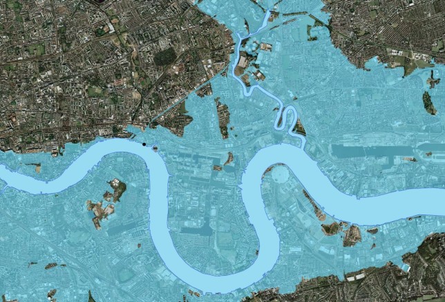


In December 2013, thousands of homes in coastal areas across the UK were affected by flooding caused by gales and high tides. Sea levels rose to their highest since the floods of 1953, which left 307 people dead and 40,000 homeless.
Coastal areas were not the only communities threatened by event. The low-lying metropolis of London, home to over 8 million people, is susceptible to flooding from tidal surges and heavy rainfall in the Thames catchment. But in this instance, preparation had paid off, in the form of the Thames Barrier, built in 1982 to protect London against a 1-in-1000-year flooding event. It spans 520 metres across the river and consists of ten steel flood gates – each as high as a five storey building. There have been 203 flood defence closures in its forty years, saving billions in damages and preventing the flooding of as much as 125 square miles of the city.
In the floods of 2013, as many as 800,000 homes and businesses were protected by flood prevention schemes over a period of 24 hours. “Flood risk management assets, including the Thames and Hull Barriers, have protected thousands of homes and businesses from sea levels higher in some places than those that occurred during the devastating floods of 1953.” said Dr Paul Leinster, the UK Environment Agency’s chief executive at the time.
The successful protection of London from a potentially devastating flood received little media attention. A disaster prevented is less newsworthy than one which actually happened. The Understanding Risk Averted Disaster Award marks a significant effort to bring stories of disasters avoided to light, so that their lessons might be learned and other communities kept safe. The Averted Disaster Award identifies and receives applications from individuals, project teams and organizations of all sizes, regions and industries whose successful DRM interventions have not been recognized.
If your organization or project meets this description, you’re invited to submit your applications here. The winning applicants will receive up to five cash grants and tickets to attend Understanding Risk 2022, the world’s largest forum for views and innovations in DRM globally. The intervention highlighted in the winning application will be featured in a documentary to be premiered at the event.
Schools Saved and Lessons Learned in the Nepal Earthquake
In Nepal, schools which had been retrofitted against seismic shocks performed much better than those which were not in the devastating earthquake of 2015.
On Saturday, April 25, 2015, a M7.8 earthquake occurred about 80km northwest of Kathmandu, the capital of Nepal, followed by numerous aftershocks. The earthquake resulted in 8,790 casualties, 22,300 injuries, and impacted over 8 million people – about one-third of the population of Nepal – in 31 districts, resulting in an estimated $US 7 billion of direct economic losses. In the education sector, 8,242 public schools were affected, including over 25,000 classrooms completely destroyed, and 22,000 partially damaged.
Amid this destruction and loss of life, it is easy to overlook how much worse it could have been without timely actions taken years earlier. The School Earthquake Safety Program (SESP)was initiated in 1997 to raise earthquake safety awareness in Nepal through outreach and capacity building amongst teachers, students, and parents, and to strengthen school buildings through seismic retrofitting. By the time of the earthquake, 300 schools had been retrofitted, 160 of them in the most affected districts. Of these 160 schools, 125 reported no damage in the earthquake, with 35 reporting only hairline cracks. Notably, none of the retrofitted schools collapsed or needed major repairs.
Amid the loss and destruction of the event, this small but significant victory received little media attention. The Understanding Risk Averted Disaster Award marks a significant effort to bring stories like this to light, of disasters avoided and lives saved, so that their lessons might be learned and other communities kept safe. The Averted Disaster Award identifies and receives applications from individuals, project teams and organizations of all sizes, regions and industries whose successful DRM interventions have not been recognized.
If your organization or project meets this description, you’re invited to submit your applications here. The winning applicants will receive up to five cash grants and tickets to attend Understanding Risk 2022, the world’s largest forum for views and innovations in DRM globally. The intervention highlighted in the winning application will be featured in a documentary to be premiered at the event.